 |
 |
 |
 |
Rio Chiantone 

Description:
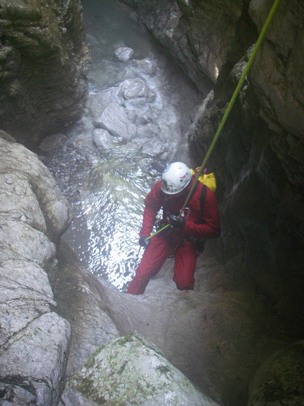
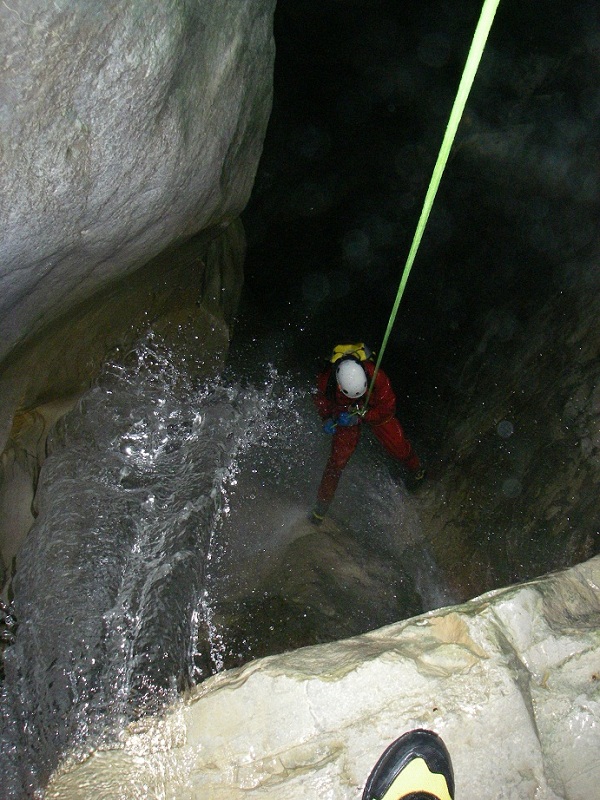
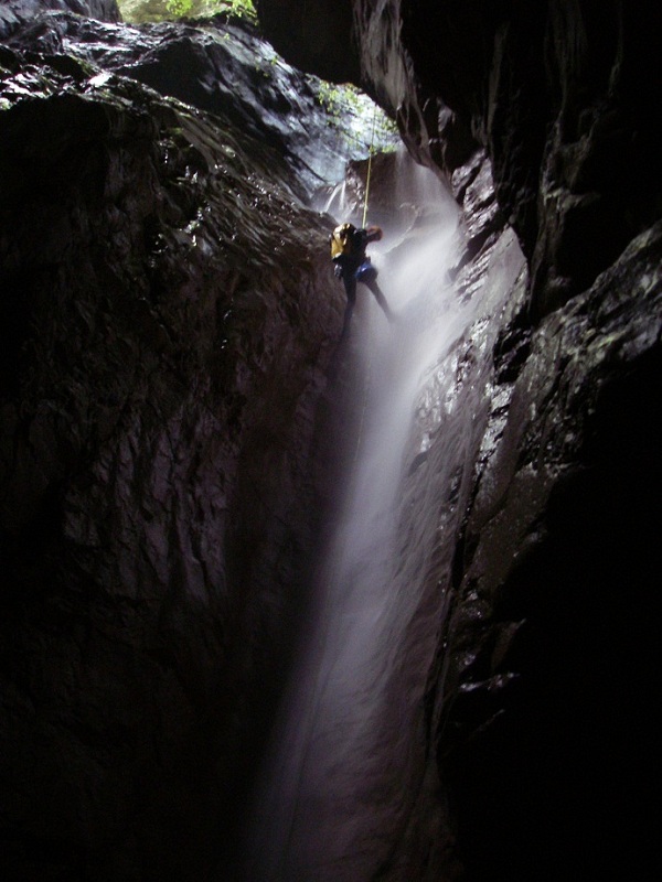
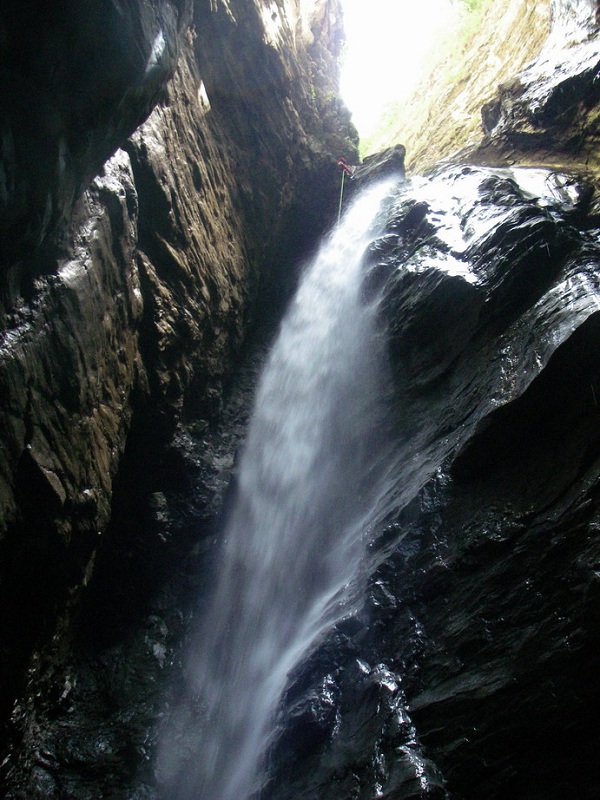
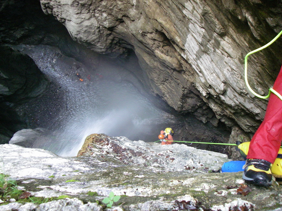
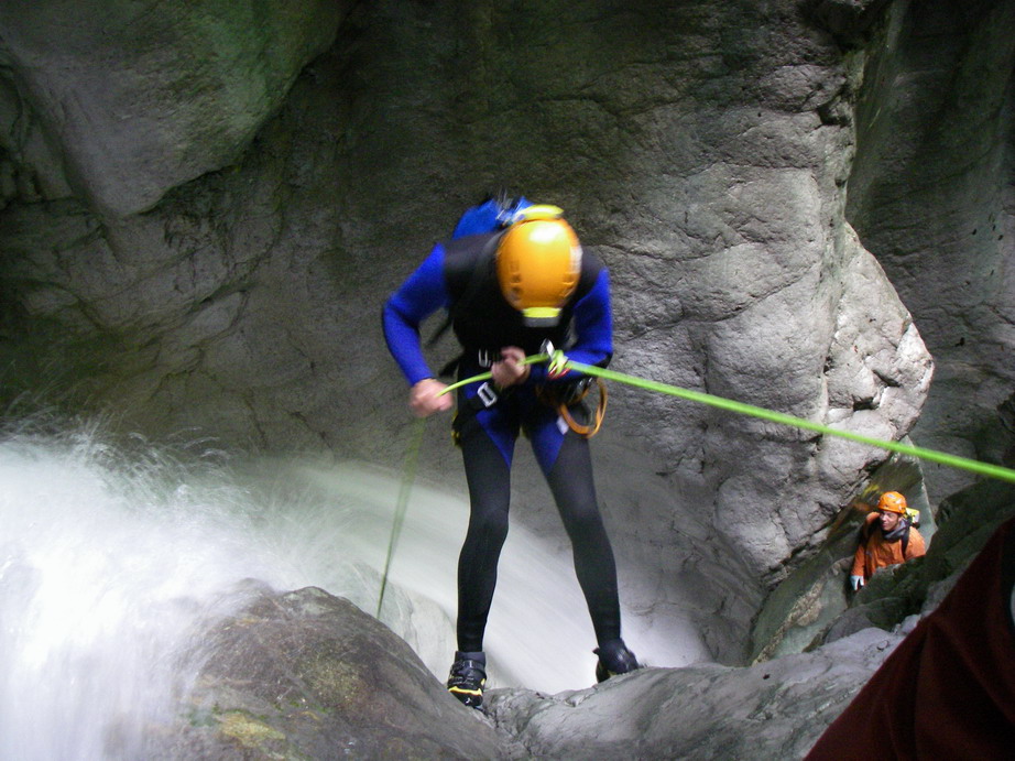
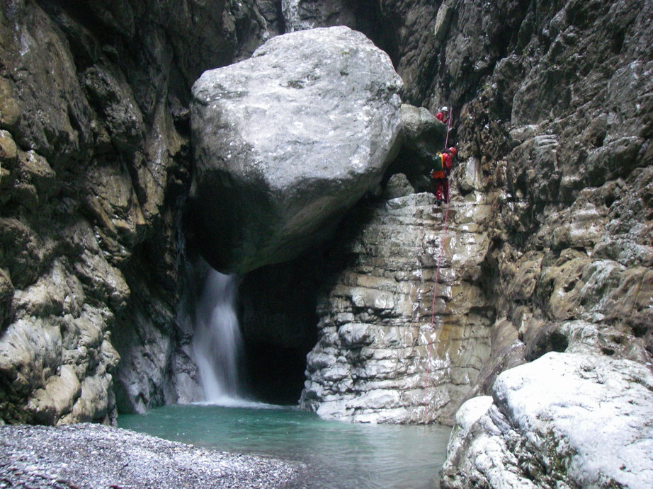
The Rio Chiantone, in the section above the confluence with the Torrente Vinadia, is a highly encased canyon with many spectacular pitches. Unfortunately,
this beautiful route is affected strongly by the presence of waste and garbage that litter the bottom of the canyon; a clear sign of disrespect that sadly
occurs here.Despite this drawback, the water that flows within the canyon remains fairly clean, probably due to continuous attrition of the riverbed that accelerate the process of self-cleansing.
It is advised that this route is followed only after a few days of rain that will increase the flow and help to "clean up" the riverbed, mitigating, to some extent, the unsightly effects of the waste.
As a tributary of the Torrente Vinadia, it is necessary to continue along the second part of the Torrente Vinadia. See also, therefore, the description for that canyon, as that information is omitted here.

Zone:
Friuli Venezia Giulia - Lauco (UD)Elevation and length:
Entrance: 800 mExit: 350 m
Height difference: 450 m
Length: 3700 m
Highest pitch: 52 m
Advised decent period:
From June to September Exposure:
South-westTimings:
Approach: 5 minsDescent: 4h 30 mins
Return: See description of the Torrente Vinadia
Shuttle:
12 KmAnchors:
Excellent ProCanyonAdvised ropes:
2 of 60 m + emergency ropeGear:
Complete wetsuit, bolting kit Escapes:
No escapes along the route of Rio Chiantone, but see description for exits in the latter Torrente VinadiaMap:
Carta Tabacco 1:25000 foglio n° 013 - Prealpi Carniche - Val Tagliamento Interest:
National Difficulty:
V5 a3 VICoordinates (WGS84) for downstream (valley) parking:
46° 24' 37,4'' N 12° 58' 1'' E Coordinates (WGS84) for upstream (mountain) parking:
46° 26' 24'' N 12° 58' 24'' E Approach to the valley (lower car park):
See description for Torrente VinadiaApproach to the mountain (upper car park):
From the lower car park, go back, staying on the SP125 and follow it for about 3 km. Just before the bridge over the River But, turn left and continue along
the provincial road SP21 to Casanova. Here, turn left and take the road that leads uphill to the town of Fusea. Continue on this road towards Buttea, however,
before reaching Buttea, after a stretch of downhill road, you will cross the bridge over the Rio Chiantone (about 8 km).Park in the small open space just after the bridge (space for up to 2 cars).
Approach to the canyon (walking):
To reach the riverbed, walk uphill from the bridge on the road for about 10 metres. Then enter the forest in the direction of the stream, following a path marked
with the ProCanyon signs (white and blue).Description and technical notes:
01 - NA 13 R 02 - MC + 2 RB + P 20 R
03 - P 3 R
04 - P 9 R
05 - MC + P 25 L
06 - P 10 L
07 - J 2
08 - T 3
Continue for 400 m with various small descents that can be downclimbed or possibly jumped
09 - MC + P 52 R
10 - MC + P 7 L
11 - MC + P 5 L
12 - MC + P 12 + DEV L
13 - J 2
14 - D 2
15 - MC + P 7 R
16 - MC + P 10 R
Confluence with Torrente Vinadia. To continue, please see the description of Torrente Vinadia
Exit:
See the description of Torrente VinadiaNotes:
The first descent was made by L. Panicucci and M. Sivelli in August 1986.URL:http://www.canyoneast.it
Layout, design & revisions © 2017, CanyonEast Canyoning Team - Seba Broili, Vanessa Johnston, Romy Siegl, Cristian Vogrig
Webmaster: uomonero@canyoneast.it - Revised - - 22/08/2017
Layout, design & revisions © 2017, CanyonEast Canyoning Team - Seba Broili, Vanessa Johnston, Romy Siegl, Cristian Vogrig
Webmaster: uomonero@canyoneast.it - Revised - - 22/08/2017


